"Curaçao Dutch: Curaçao; is an island in the southern Caribbean Sea, off the Venezuelan coast, that forms part of the Dutch Caribbean... Prior to 10 October 2010, when the Netherlands Antilles was dissolved, Curaçao was administered as the Island Territory of Curaçao, one of five island territories of the former Netherlands Antilles...The name "Curaçao" has become associated with a shade of blue, because of the deep-blue version of the liqueur named Curaçao (also known as Blue Curaçao)...The original inhabitants of Curaçao were Arawak peoples. Their ancestors had migrated to the island from the mainland of South America, likely hundreds of years before European encounter.
The first Europeans recorded as seeing the island were members of a Spanish expedition under the leadership of Alonso de Ojeda in 1499. The Spaniards enslaved most of the Arawak as their labor force. They sometimes forcibly relocated the survivors to other colonies where workers were needed. In 1634, after the Netherlands achieved independence from Spain, Dutch colonists started to occupy the island. European powers were trying to get bases in the Caribbean.
The Dutch West India Company founded the capital of Willemstad on the banks of an inlet called the 'Schottegat'. Curaçao had been ignored by colonists, because it lacked gold deposits. The natural harbour of Willemstad proved to be an ideal spot for trade. Commerce and shipping — and piracy—became Curaçao's most important economic activities. In addition, in 1662 the Dutch West India Company made Curaçao a centre for the Atlantic slave trade, often bringing slaves here for sale elsewhere in the Caribbean."
 "The flag is a blue field with a horizontal yellow stripe slightly below the midline and two white, five-pointed stars in the canton.
The blue symbolises the sea and sky (the bottom and top blue sections,
respectively) divided by a yellow stroke representing the bright sun
which bathes the island. The two stars represent Curaçao and Klein
Curaçao, but also 'Love and Happiness'. The five points on each star symbolise the five continents from which Curaçao's people come."
"The flag is a blue field with a horizontal yellow stripe slightly below the midline and two white, five-pointed stars in the canton.
The blue symbolises the sea and sky (the bottom and top blue sections,
respectively) divided by a yellow stroke representing the bright sun
which bathes the island. The two stars represent Curaçao and Klein
Curaçao, but also 'Love and Happiness'. The five points on each star symbolise the five continents from which Curaçao's people come."

"The Queen Emma Bridge (aka; Swinging Lady) is a pontoon bridge across St. Anna Bay in Curaçao. It connects the Punda and Otrobanda quarters of the capital city, Willemstad. The bridge is hinged and opens regularly to enable the passage of ocean going vessels. On the opposite end from the hinge is a small shelter where an operator controls two diesel engines turning propellers. The propellers are mounted perpendicular to the length of the bridge and allow it to swing parallel to the shore. The process only takes a few minutes to complete. The bridge was built in 1888 and was completely renovated in 1939. Originally it was a toll bridge. Individuals without shoes were permitted to cross the bridge without paying the toll; however, today, a toll is no longer applied. When the bridge swings open, two ferries spring into action to bring pedestrians across the water. The ferries are also free of charge."
 |
Lots of forts around the island - can't remember the name of this one
|
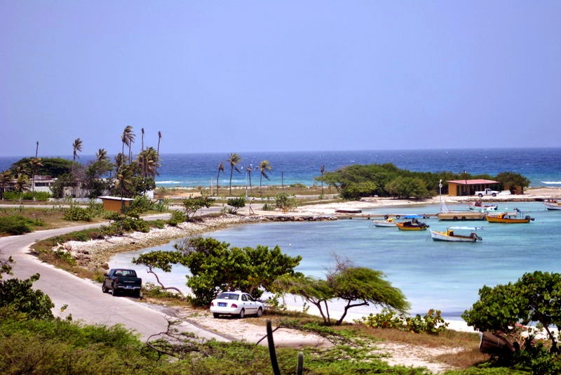
"While tourism plays a major role in Curaçao's economy, it is less reliant on tourism than other Caribbean countries. Most tourists originate from the Eastern United States, South America and the Netherlands. It currently leads the Caribbean in cruise tourism growth with 610,186 cruise passengers in 2013, a 41.4% increase over the prior year. Hato International Airport received 1,772,501 passengers in 2013 and recently announced capital investments totaling US$48 million aimed at transforming the airport into a regional hub by 2018.Beginning in early 2014, the Lynx rocketplane is expected to be flying suborbital space tourism flights and scientific research missions from a new spaceport on Curaçao.The island's insular shelf has a sharp drop-off known as the "Blue Edge." Scuba diving tourists often visit for this vista. Coral reefs for snorkeling and scuba diving can be reached without a boat. The southern coast has calm waters as well as many small beaches, such as Jan Thiel and Cas Abou. The coastline of Curaçao features numerous bays and inlets which serve as popular mooring locations for boats.
Some of the coral reefs are affected by tourism. Porto Marie Beach is experimenting with artificial coral reefs in order to improve the reef's condition. Hundreds of artificial coral blocks that have been placed are now home to a large array of tropical fish."
We wandered everywhere including both sides of St. Anna Bay. We didn't take the tours, as usual.
Then we came across the Floating Market. "While exploring Punda, don't miss the
Floating Market. All along the Sha. Caprileskade, just around the corner
from the Handelskade, you will find one of Curaçao's most famous and
picturesque sights. Venezuelan merchants selling their fresh produce
from small fishing boats. During the days they spend on our island
between their trips to and from Venezuela, their authentic fishing boats
double as living quarters. Nearby on the plaza Jo Jo Correa there is
often a small artisans' market featuring local crafts" The picture I bought still hangs in the cottage.
 |
Daddy was kind enough to let me take this sweet girl's picture
|
 |
| Beautiful mosaic - wish we could have taken it home | |
After a day of roaming the town, our memory gets a bit murky. There was a snorkeling & Swim with the Dolphin tour & we didn't go . So, these pictures were taken by Dario.
We had to
return to the boat to go around to the other side of the island as
there was a beach party that night.
 |
Back on the GRACE- these were my game buddies- we played (gambled) every day
|
No one really knew what to expect at the beach so when we arrived we were amazed at how they transformed the area.
There was a monster bon-fire; a wooden stage/dance floor; bar & a huge area filled with tables that were filled with food.
 |
| The band was phenomenal !!!!! |
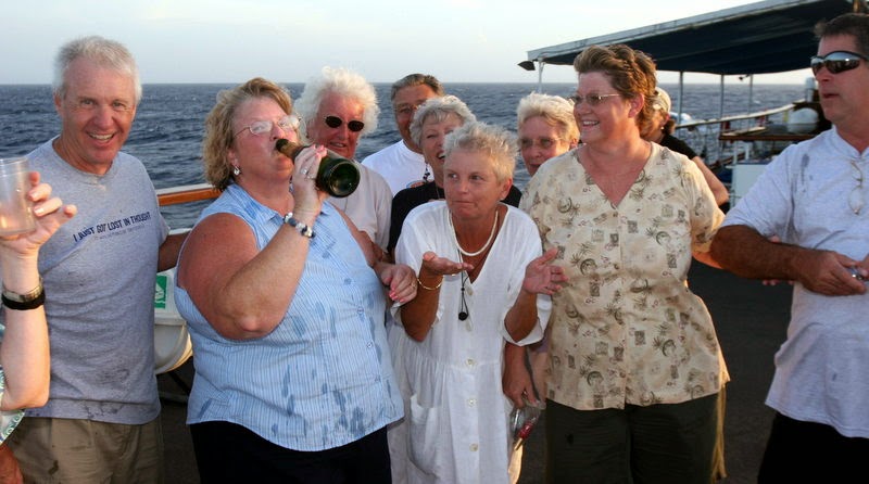
I think by looking at the pictures, we all had a blast!
 |
Another fort in the day...
|
 |
| And at night.... |
Good bye Curaçao
Next stop...Aruba


.JPG)